

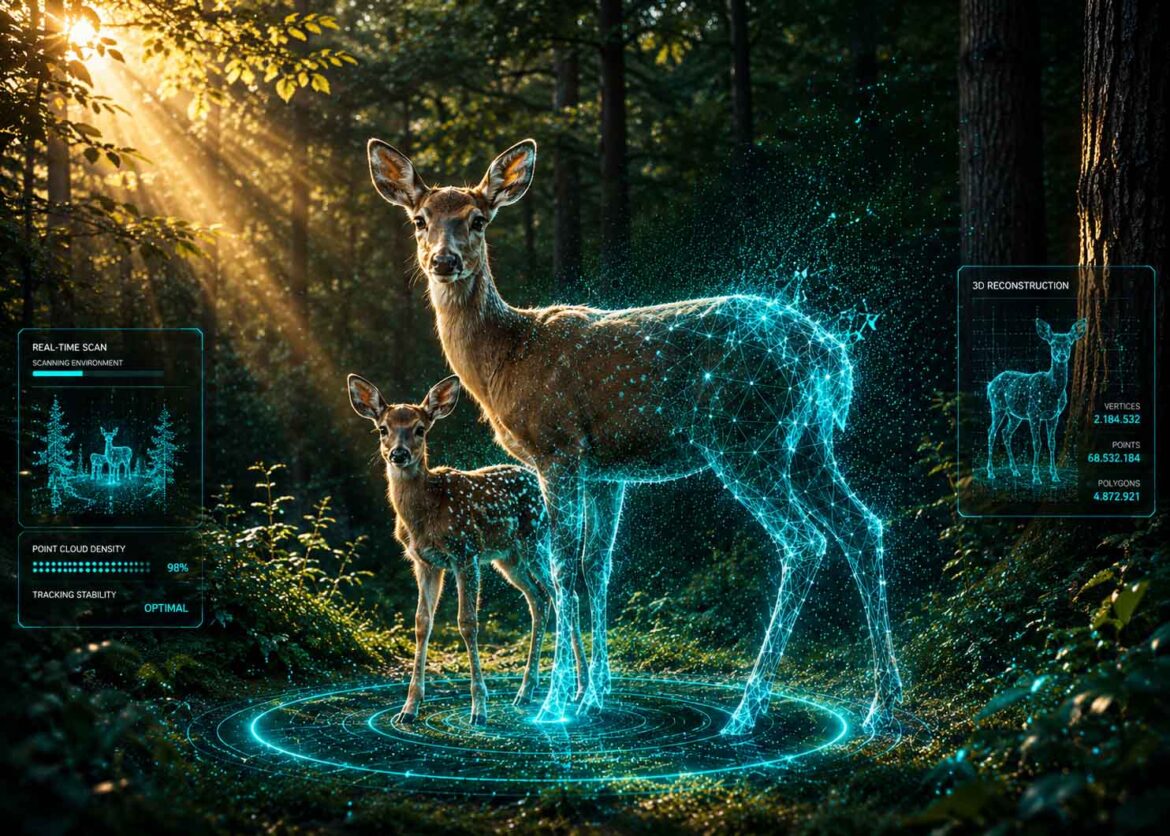
A video of a deer in the forest becomes a 3D hologram, anchored exactly to its real location, with measurable movement data. An example of how any fleeting moment could one day be captured permanently.
Visualization: a forest clearing in daylight, above which a semi-transparent 3D hologram of a deer with a fawn hovers, small overlaid data fields showing distance and speed values beside it, in the background a subtle GPS coordinate icon hinting at the anchoring to the real location | inspired by the original video by Bilawal Sidhu (@bilawalsidhu) | Image: © Ulrich Buckenlei | XR Stager Online Magazine | VISORIC GmbH
The oldest documented memory technique of Western culture, the method of loci or memory palace, traces back to the Greek poet Simonides of Ceos and deliberately uses the brain’s spatial navigation system to bind pieces of information to specific locations along an imagined path. Current research still confirms today why this principle is so effective: memory tied to the same place is demonstrably stronger than memory without a spatial reference.[1]
Photos and video have technically severed this connection for decades. A recording lands in the camera roll, separated from the place where it was made, only a timestamp and perhaps a GPS tag in the file header still hint at where exactly it was taken. This is precisely where a concept comes in that Bilawal Sidhu introduced publicly: every video ever filmed could become a lasting 3D hologram, anchored exactly at the real place where it was created, demonstrated with a clip he filmed himself of a deer with a fawn.[2]
Whoever is speaking here is no random voice from social media. Sidhu previously served as Senior Product Manager at Google for Spatial Computing and 3D Maps, including Google Maps Immersive View, the ARCore Geospatial API, and YouTube VR Capture, and today he is Technology Curator at TED and a creator with more than 2.1 million followers.[3] What he shows in his video is therefore no distant vision of the future, but the direct application of technologies he himself helped build, and this exact closeness to the field is why his project is worth a closer look.
What stands out here as a surprising social media post is technically precise and explainable, and already well documented in the field.
For spatial computing and digital twins, this is more than a personal nature video, the deer in the forest is merely the easy-to-follow example for a considerably larger principle. It shows, by example, how any piece of physical reality can be made permanent, spatially anchored, and understandable, whether that means a fleeting moment in nature, damage to a piece of equipment, or the state of a construction site. That is exactly the core principle behind every professional digital twin, made visible here through a single example.
- The method of loci has tied memory to specific places since antiquity.
- Photos and video technically severed that connection.
- Bilawal Sidhu anchors a video exactly at its real place of origin.
- Demonstrated with a self-filmed clip of a deer with a fawn.
- Same principle as every professional digital twin.
This article explains how a spatially anchored 3D hologram technically emerges from an ordinary video, what the deer example stands in for, where the limits of the current project lie, and why the same principle matters far beyond a single nature video.
From Recording to a Lasting Place of Memory
Humans have always organized memory spatially. The method of loci uses an imagined, familiar path, say through one’s own house, and attaches a thought one wants to remember to every stop along that path. Anyone who mentally retraces the path later finds the thoughts again exactly where they placed them. Cognitive research still confirms today that this principle works because the human brain stores and retrieves spatial information especially reliably.[1]
Photos and video have technically severed this thousands-year-old connection between memory and place, without most people ever consciously noticing. A recording lands in the camera roll, sorted chronologically by date, not by place. The place itself becomes, at best, a line of metadata that nobody looks at unless they specifically go searching for it.
This is exactly where the concept Sidhu introduced publicly comes in: every video ever filmed could become a lasting 3D hologram, anchored exactly at the real place where it was created. He says he first implemented the principle with photos, and it now works with any video, demonstrated with a clip he filmed himself of a deer with a fawn in the forest.[2] That turns a technical footnote in a file header back into what it originally was: the actual anchor point of memory.
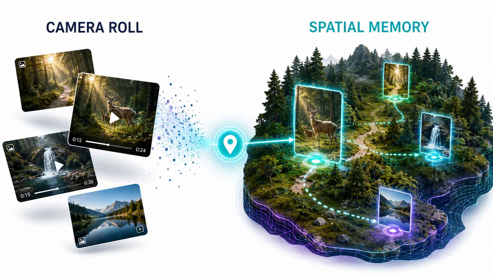
From video to 3D portal.
Infographic: restoring the connection between a recording and its real place of origin | inspired by the original video by Bilawal Sidhu (@bilawalsidhu) | Graphic: © Ulrich Buckenlei | XR Stager Online Magazine | VISORIC GmbH
This shift, from the isolated recording back to the spatially anchored place of memory, fundamentally changes how people could handle their own recordings. Instead of searching through an endless, unsorted camera roll, it becomes possible to find memories again exactly where they actually happened, just like in the ancient memory palace.
For such anchoring to be technically possible at all, it takes two separate steps: an actual 3D reconstruction from the video material, and a precise link between that reconstruction and real coordinates. How this technical core works is shown in the next chapter.
- The method of loci has tied memory to places since antiquity.
- Photos and video technically severed that link.
- The place becomes, at best, unnoticed metadata.
- Sidhu anchors videos back to their real place.
- First tested with photos, now works with any video.
This makes clear that the real innovation lies not in the act of filming itself, but in restoring a connection that has long existed but gone technically unused. Only the combination of 3D reconstruction and precise place anchoring turns an ordinary video back into a genuine place of memory.
How a Video Becomes a Place-Bound 3D Hologram
That an ordinary smartphone video can turn into a walkable, spatially anchored 3D scene at all rests on the interplay of two technically separate steps that only together deliver the actual result.
The starting point is a normal, handheld iPhone video with no depth sensor or special rig. Techniques such as 3D Gaussian Splatting, a reconstruction method introduced at the SIGGRAPH conference in 2023, can compute a walkable, volumetric 3D scene from a sequence of images, one in which every object sits at its actually measured depth in space, visible at the portal-like 3D surface in the original clip.[4] Sidhu himself publicly explained the basics of this technique as early as 2023 and listed exactly the applications that his later project would go on to anticipate, including the creation of real-time holograms of real objects for spatial computing and XR.
The second layer is geo-anchoring, the linking of the 3D scene to an exact real position. This is precisely the field Sidhu helped shape at Google, where he led, among other things, the development of the ARCore Geospatial API, an interface that lets applications anchor digital content precisely to coordinates worldwide, independent of local reference points or markers placed in advance.[5]
Notably, both steps work independently of each other, but only together produce the actual effect. A pure 3D reconstruction without geo-anchoring would be a loose, freely floating model with no fixed place. A pure location marker without 3D reconstruction would be nothing more than a point on a map, with no walkable content behind it.
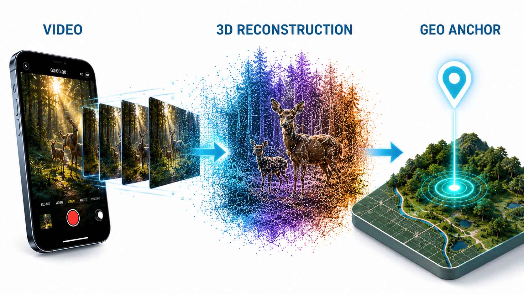
Reconstruction meets geo-anchoring.
Infographic: from video through 3D reconstruction to precise place anchoring | inspired by the original video by Bilawal Sidhu (@bilawalsidhu) | Graphic: © Ulrich Buckenlei | XR Stager Online Magazine | VISORIC GmbH
For the viewer, this technical split disappears completely. What becomes visible in the end is a single, seamless experience, a video that turns into a walkable scene and stays anchored exactly at its real place. This seamlessness is exactly what makes the concept so immediately understandable, even without technical background knowledge.
This reconstruction, however, is only half the story. What additional information sits inside the 3D scene itself is shown in the next chapter.
- 3D Gaussian Splatting reconstructs scenes from image sequences.
- No special camera or depth sensor required.
- The ARCore Geospatial API anchors content to real coordinates.
- Reconstruction and anchoring work as technically separate steps.
- Only together do they produce the walkable hologram.
For users, this means in practice that both technologies are already individually mature and proven, what is actually new about Sidhu’s project is their deliberate combination. That exact combination is what turns two known building blocks into a surprising new result.
When Movement Itself Becomes Data
Above the pure 3D scene lies a second, often overlooked layer: measured movement data that turns the video into a structured spatial record rather than a mere playback.
In the clip shown, each of the two animals is displayed individually with how far it walked and at what speed, visible as overlaid measurements right next to the 3D representation.[2] This is not a visual effect, but a quantified dataset extracted from the video material, one that could in principle be analyzed, compared, and processed further.
The decisive difference from an ordinary video lies exactly there: a video shows what happened, a spatially anchored 3D model with movement data additionally answers how far, how fast, and at exactly which position. This principle, making real states measurable rather than merely visible, is the common denominator of every form of digital twin, regardless of the use case.[6]
This measurability also changes what such a recording is actually good for. An ordinary video can be watched, but not searched or analyzed. A dataset with position, distance, and speed, on the other hand, can be sorted, compared, and carried over into other systems, even if in the current project nobody but the creator himself can access it yet.
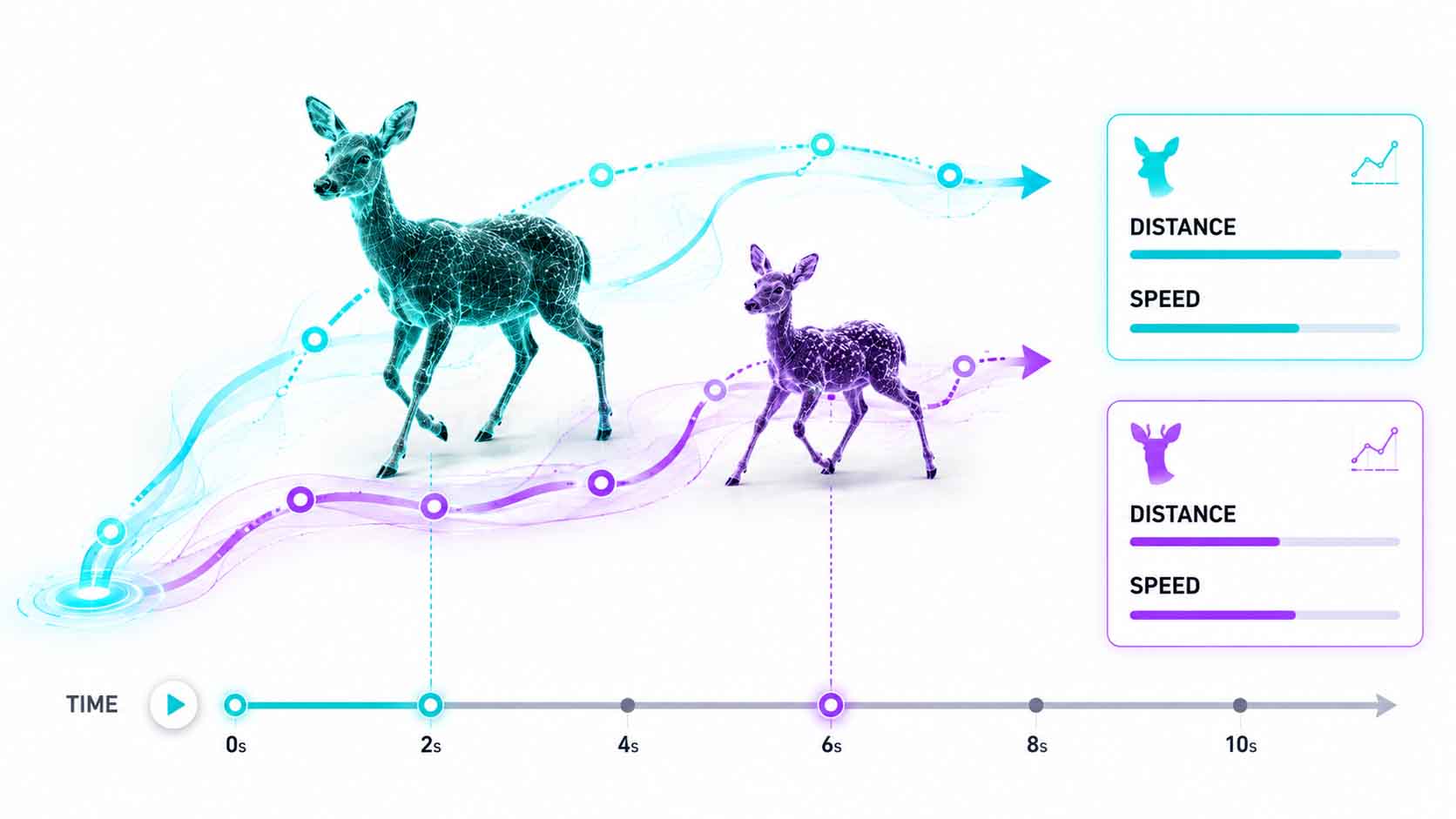
Movement becomes a measurable dataset.
Infographic: movement data as an additional, structured layer above the pure 3D scene | inspired by the original video by Bilawal Sidhu (@bilawalsidhu) | Graphic: © Ulrich Buckenlei | XR Stager Online Magazine | VISORIC GmbH
This turns a single, personal nature video into a small illustrative example of how any real movement process can in principle be translated into structured, spatial data. What is demonstrated here on two wild animals follows exactly the same principle as sensor data capture in every industrial digital twin.
For such a dataset to be genuinely reliable, though, it must be clear what the current project actually delivers already and what still remains merely a concept. That distinction is exactly what the next chapter covers.
- Distance and speed are captured separately for each animal.
- Not a visual effect, but an extracted dataset.
- Video shows what happened, movement data shows exactly how.
- Measurability rather than mere visibility is the common denominator.
- Same principle as sensor data in industrial twins.
This transferability is exactly why the example is interesting far beyond a single nature video. Once movement itself becomes data, the same principle can in principle be applied to any kind of real, physical movement.
What a Geo-Anchored Hologram Is Not Yet
As impressive as the example shown may be, it remains a personal, unpublished project by an individual artist, not a publicly usable tool. This framing matters for assessing the technology realistically.
Sidhu has published neither the exact technical pipeline nor a publicly accessible tool that others could use to replicate the same workflow. It is a personal project, not a commercial product that could be installed or subscribed to.
That the project is still under construction is shown by Sidhu himself: in parallel, he is actively looking for developers with experience in Rust, WASM, and Tauri for a related, larger geospatial undertaking, a clear sign that the underlying infrastructure is still being built rather than arriving ready-made off the shelf.[7]
Likewise, returning to the real place, actually going back with an AR device to the original position and seeing the hologram live, remains, for now, a conceptual ambition rather than a function actually demonstrated in the video. Persistent AR anchors and cloud anchors, which would technically enable exactly that, already exist as an infrastructure topic within Google ARCore and Apple ARKit, but have not yet been demonstrated working together here.[8]
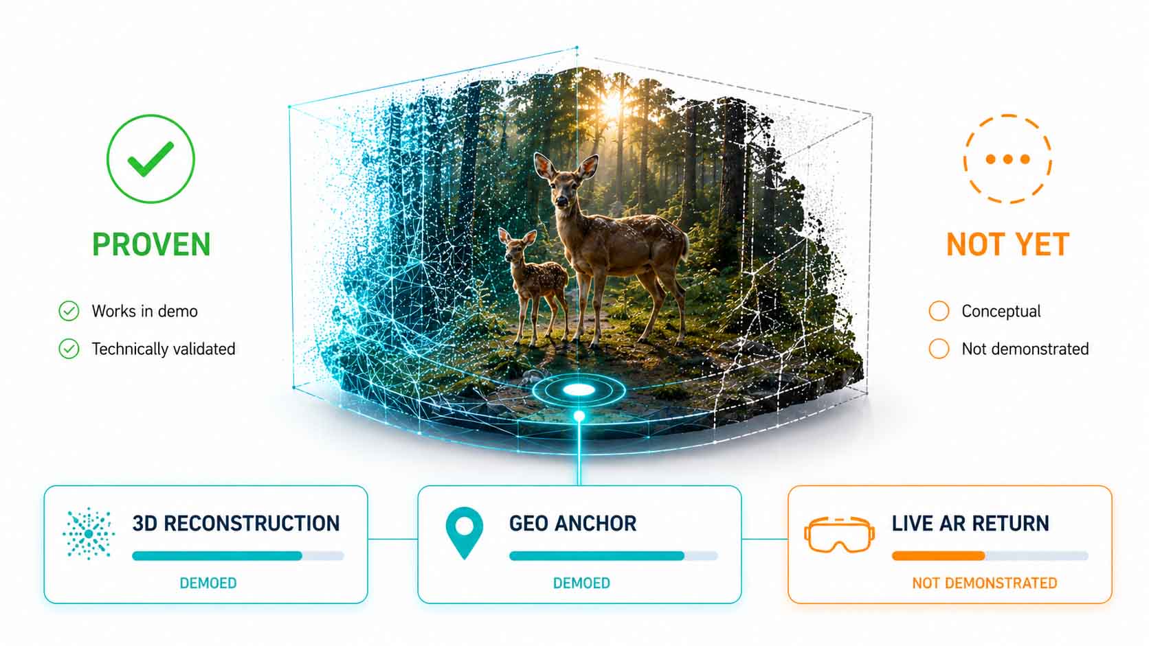
Returning to the place with AR: still just a concept.
Infographic: the current state of the project between demonstrated principle and open technical implementation | inspired by the original video by Bilawal Sidhu (@bilawalsidhu) | Graphic: © Ulrich Buckenlei | XR Stager Online Magazine | VISORIC GmbH
These limitations are not a reason to downplay the project, they are a reason to place it correctly. A single, convincing demo clip proves that a principle works, it does not yet prove that it has become a mature, scalable system.
Anyone who knows this limit can assess the project realistically and recognize where related, more mature applications already exist today. Which industries could already benefit from exactly this principle is shown in the next chapter.
- Not a public tool, but a personal project.
- Sidhu is actively seeking developers for the infrastructure.
- Returning to the place with AR remains just a concept.
- Persistent AR anchors exist, but are not demonstrated here.
- A demo clip proves the principle, not its maturity.
Anyone who knows these limits also understands that the real value of the project lies not in its technical completeness, but in making an otherwise abstract principle tangible through a single, easy-to-follow example. This exact principle can already be applied to entirely different fields today.
From Nature Film to Enterprise Documentation
Detach the principle from the deer in the forest, and a field of application emerges that reaches far beyond private memories, everywhere real conditions need to be documented permanently at their actual location.
If any video can be permanently anchored at its real place of origin, the principle applies to more than nature footage. In facility maintenance, the exact 3D state of a component, or damage, could be documented right at the spot where it occurred, permanently retrievable, instead of disappearing into a loose folder of photos.
In real estate marketing, 3D walkthroughs could be anchored directly to the real address; in training and safety documentation, a hazardous situation could be captured once in 3D and made permanently retrievable at the real location, without people needing to be physically present again later.
Event venues and tourism, too, gain a spatial storytelling format in which content no longer sits loosely on a platform, but stays firmly tied to the real place where it takes on meaning. The market for such spatial applications is growing accordingly: spatial computing overall is seeing significant growth rates in 2026, driven precisely by applications that link real places with digital content.[9]
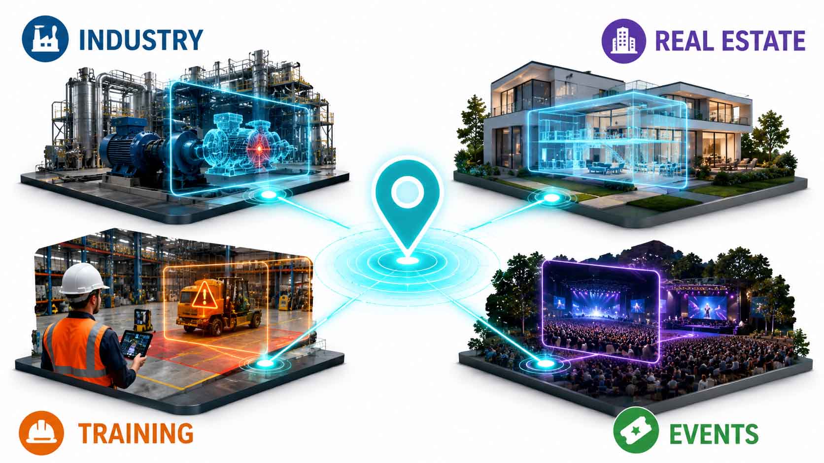
One principle, many industries.
Infographic: application fields of spatially anchored 3D documentation beyond the original example | inspired by the original video by Bilawal Sidhu (@bilawalsidhu) | Graphic: © Ulrich Buckenlei | XR Stager Online Magazine | VISORIC GmbH
A central advantage runs through all of these applications: information firmly tied to its real place gets lost less often, gets misattributed less often, and is available exactly when someone is actually standing at that place. For companies with many scattered sites or facilities over time, that is a substantial practical advantage.
This range of possible applications raises an obvious question: if a single creative technologist can already demonstrate this principle with a private video, how close is an automated, AI-driven version of it really? That is exactly what the next chapter addresses.
- The principle applies to any video, not just nature footage.
- Facility maintenance could document damage tied to its location.
- Real estate and training benefit from 3D anchoring.
- Event venues gain spatial storytelling.
- The spatial computing market grows significantly in 2026.
The more industries take interest in this principle, the more important the question becomes of how to reduce the manual effort behind it. That is exactly where the next stage of development begins.
When AI Ushers in the Next Stage
What today is still manual, individual work is already hinted at by Sidhu’s second, larger project as an automatable, AI-driven next step.
Alongside the deer video, Sidhu is working on a considerably larger undertaking: determining the exact 3D position of every photo taken at TED conferences, including attribution to its creator, a project for which he is specifically seeking developers with experience in large-scale, geospatial datasets.[10] While the deer video is a single, manually created example, this second project targets an entire collection of recordings, placed automatically rather than processed one by one.
That this direction is no fringe phenomenon is shown by a considerably bigger development published in December 2025: Meta introduced two AI model families, SAM 3 and SAM 3D, which, according to Sidhu’s own professional assessment, for the first time broadly connect what used to be separate, visual understanding of what is visible in a scene, and spatial understanding of exactly where it is located. He himself describes this as an early infrastructure layer for physical AI.[11]
The development trajectory is thus clearly visible: from the manual, individual project of a creative technologist to AI systems that could deliver spatial understanding automatically and at large scale, with direct consequences for wildlife observation, virtual worlds, and the next generation of spatially aware robots, as Sidhu himself notes.
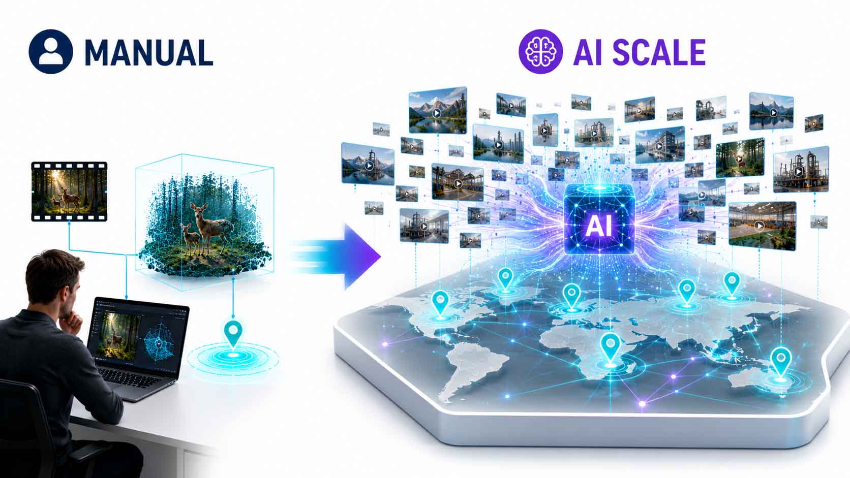
From individual project to AI-driven automation.
Infographic: development line from manual spatial anchoring to AI-driven automation | inspired by the original video by Bilawal Sidhu (@bilawalsidhu) | Graphic: © Ulrich Buckenlei | XR Stager Online Magazine | VISORIC GmbH
For companies holding large volumes of image and video material, the effect would be substantial. Instead of manually placing each recording individually, as the deer video still demonstrates, a system would emerge that automatically recognizes where a recording was made and categorizes it accordingly, with no additional manual effort per file.
This step, from manual, individual anchoring to automated, AI-driven placement, is technically demanding but by no means science fiction. It builds directly on technologies that already exist today and shows where the entire spatial computing industry is currently heading. How quickly these technologies are already spreading into everyday use is shown in the next chapter.
- Sidhu’s second project places TED conference photos automatically.
- Meta’s SAM 3 and SAM 3D connect visual and spatial understanding.
- Sidhu calls this an early infrastructure layer for physical AI.
- Development spans from individual project to automated AI.
- Consequences reach as far as spatially aware robots.
This automation is also why the field is developing so quickly right now. What used to be an elaborate individual project is increasingly becoming a capability that can simply be integrated into existing applications.
From Artist’s Project to Everyday Tool
While geo-anchoring remains a thing of the future, the first part of the principle, turning flat recordings into explorable 3D scenes, has long since reached the mass market.
Consumer apps today turn ordinary photos directly on the smartphone into explorable 3D point clouds using on-device AI, with no special camera or depth sensor, producing cinema-quality virtual camera moves through one’s own memory as a result.[12] What still required elaborate reconstruction software and specialist knowledge just a few years ago now runs today as a simple app in the background.
In parallel, hardware providers such as Looking Glass are bringing portable devices to market that display exactly such recordings as physically visible holograms, a sign that explorable 3D memories have already arrived in everyday consumer life.[13] The market for spatial computing applications overall is growing significantly accordingly in 2026, driven by exactly this shift of spatial tools from specialist audiences into the mass market.[9]
What is still missing from these mainstream tools is exactly the component that defines Sidhu’s project: the fixed anchoring to a real place. Existing apps produce walkable 3D scenes, but then mostly leave them sitting loosely in an app’s own gallery, with no link to an exact, retrievable real position.
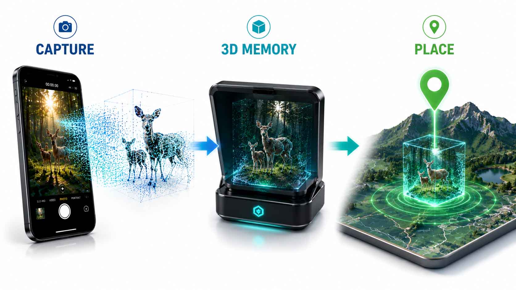
3D is everyday life, place anchoring is still missing.
Infographic: from artist’s project to a widespread everyday tool for 3D reconstruction | inspired by the original video by Bilawal Sidhu (@bilawalsidhu) | Graphic: © Ulrich Buckenlei | XR Stager Online Magazine | VISORIC GmbH
For providers of these consumer apps, this represents an obvious but so far unused extension. The technical foundation for reconstruction already exists in millions of active deployments, all that’s missing is the step Sidhu demonstrates with a single example, the fixed link to a real position.
That is the gap on which it currently depends who makes the next stage of this development broadly available first. How this gap fits into the bigger picture of the digital twin ecosystem is shown in the final chapter.
- Consumer apps already reconstruct photos via on-device AI.
- Looking Glass brings portable hologram devices to market.
- The spatial computing market grows significantly in 2026.
- Fixed place anchoring is missing from mainstream apps.
- Sidhu’s demonstration project closes exactly this gap.
This gap is more than a technical footnote, it decides whether a 3D memory stays permanently findable or vanishes into an app gallery among thousands of others. That is exactly the point that leads to the final, larger question of this article.
The Spatial Memory Palace as the Next Stage of the Digital Twin Ecosystem
Zoom out from the single example, and a principle emerges that matches exactly the core of every professional digital twin, just demonstrated here on a single deer in the forest.
The preceding chapters have shown how a single video becomes a 3D scene, how movement data makes that scene measurable, where the limits of today’s prototype lie, and where development through AI-driven automation is headed. Together, these building blocks form a principle that reaches far beyond a single nature video.
The difference between Sidhu’s personal project and a professional digital twin lies not in the underlying principle, but in scale and structure: both permanently connect real, spatial information to its physical place of origin, and only that connection makes it genuinely usable.[6] Current industry analyses confirm that exactly this connection between sensors, AI, and spatial representation is gaining importance across industries in 2026, from personal memories to industrial applications.[14]
The real value of this example lies exactly in showing how low the barrier to entry has become. If a single creative technologist, with a phone and a side project, can already anchor real moments permanently in space, the argument that one’s own physical environment is too complex for this loses its force.
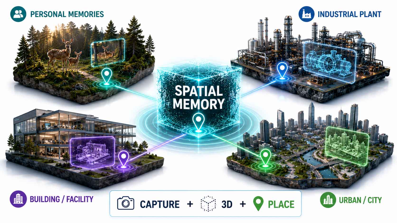
One principle, every scale.
Infographic: the spatial memory palace as a planetary-scale application of the same principle behind professional digital twins | inspired by the original video by Bilawal Sidhu (@bilawalsidhu) | Graphic: © Ulrich Buckenlei | XR Stager Online Magazine | VISORIC GmbH
For companies investing in digital twins and spatial computing, a clear strategic consideration follows from this. If even a single, private nature video can reliably be turned into a spatially anchored, measurable 3D model, the question for every company becomes which part of its own, considerably more valuable operational reality is still being managed without its own spatial place of memory.
Research and early broad adoption show that the individual building blocks of this capability are already technically mature and usable today. The path from an impressive individual project to everyday, company-wide practice is therefore, for companies that act now, considerably shorter than it appears at first glance.
- Sidhu’s project follows the same principle as digital twins.
- The difference lies in scale and structure, not the principle.
- Sensors, AI, and spatial representation are converging across industries.
- The barrier to entry for spatial anchoring has fallen.
- The path to company-wide practice is now much shorter.
This closes the circle of this article. What begins with the desire to permanently capture a single deer in the forest evolves into a foundational principle for the next generation of digital twins, far beyond a private nature video. Just how convincing this principle already looks in practice is shown in the video below.
When a Deer in the Forest Becomes a Lasting 3D Place of Memory
The previous chapters have shown how a spatially anchored 3D hologram technically comes into being, what movement data adds on top, and where the limits of the current project lie. Just how convincing this principle already looks is most striking when looking directly at the original clip itself.
Embedded below is the original clip by Bilawal Sidhu, in which the deer with its fawn turns from a flat video recording into a walkable, geo-anchored 3D scene with overlaid movement data.[2] The visual language of the infographics in this article, too, the 3D portal and the overlaid movement data, is directly modeled on a specific frame from this original video, in which Sidhu makes the reconstruction and the measured distance and speed of the deer visible.[15] Especially telling is that the same spatial anchoring demonstrated here for a single forest moment would be technically identical for any other real situation.
This moment, permanently capturing a fleeting encounter with nature at its real place, illustrates in an instant what the previous chapters explained technically: an ordinary video disappears into the camera roll, a spatially anchored hologram stays findable at its real place.
Video: geo-anchored 3D hologram of a deer with a fawn, with overlaid movement data per animal | Visuals by original creator Bilawal Sidhu (@bilawalsidhu) | Analysis, script, editing, and video production: © Ulrich Buckenlei | XR Stager Online Magazine | VISORIC GmbH
The video makes clear that spatially anchored 3D reconstruction is no distant future concept, but already works today with an ordinary smartphone, without a special camera and without a specialist team. For companies thinking about their own spatially anchored digital twin of their physical operations, this example shows just how close a practical implementation already is.
At the same time, the video reveals the decisive conceptual difference: it’s not the individual 3D reconstruction that’s remarkable, but the fact that the same information stays permanently findable at its exact real place of origin. That is exactly what turns a personal clip into a genuine spatial place of memory.
- The video shows the geo-anchored deer clip in its original form.
- Movement data is displayed separately for both animals.
- The anchoring would be technically transferable to any situation.
- The technology works without a special camera or specialist team.
- Permanent findability at the real place is what matters most.
This example makes tangible where spatially anchored 3D reconstruction is heading: from a personal, convincing individual clip to a reliable, lasting place of memory for everything that actually happens at real places.
From Idea to Your Own Spatially Anchored 3D Archive
A reliable, spatially anchored 3D archive doesn’t come from a single app, but from the thoughtful interplay of 3D capture, geo-referencing, and a platform that makes this information permanently usable, exactly the combination at the core of VISORIC’s work.
The expert team at VISORIC GmbH in Munich combines over 15 years of experience in 3D, AI, and XR with hands-on experience in digital twins, real-time 3D, and spatial computing, exactly the building blocks a spatially anchored 3D archive requires, whether it’s a production line, a building, a property, or an entire network of facilities. VISORIC builds the technical bridge from capture to a permanently usable, spatially anchored digital archive, tailored to a company’s actual requirements.

15 years of experience in 3D, AI, and XR: the VISORIC expert team from Munich.
Image: © Ulrich Buckenlei | XR Stager Online Magazine | VISORIC GmbH
A well-thought-out pilot project, a single facility, a single site, can often be realized considerably faster and more cost-effectively than many companies expect. VISORIC accompanies this path from the first concept through the technical capture strategy to a fully operational, permanently usable spatial archive.
- Design of spatially anchored 3D archives for industry and real estate.
- Integration of 3D capture, geo-referencing, and platform.
- From pilot project to company-wide spatial archive.
That is exactly the right starting point for a conversation: not the big, company-wide vision, but a clearly scoped, quickly implementable first step that shows how the principle translates to your own operational reality.
Do you want to permanently and spatially anchor real places, facilities, or moments in 3D?
Talk to the VISORIC expert team in Munich about digital twins, real-time 3D, and modern spatial computing platforms. Together, we’ll turn your requirements into a precise, permanently usable spatial archive, with a tangible advantage in findability, traceability, and reusability.
Contact:
Email: info@visoric.com
Phone: +49 89 21552678
Sources and References
- Spatial Metaphors for LLM Memory: A Critical Analysis of the MemPalace Architecture. arXiv, 2026.
- Bilawal Sidhu. Original post with the deer video, x.com/bilawalsidhu and Instagram reel, instagram.com/bilawalsidhu.
- Bilawal Sidhu. LinkedIn profile and career background, linkedin.com/in/bilawalsidhu.
- Kerbl, Kopanas, Leimkühler, Drettakis. 3D Gaussian Splatting for Real-Time Radiance Field Rendering. SIGGRAPH, 2023.
- Google. Official documentation for the ARCore Geospatial API, developers.google.com.
- ISO 23247. Reference framework for digital twins, general definition and core principle.
- Bilawal Sidhu. X post, call for Rust, WASM, and Tauri developers for a geospatial project.
- Google ARCore and Apple ARKit, official documentation on persistent AR anchors and cloud anchors.
- Spatial Computing Statistics 2026: Growth Trends and Market Data. TechRT, May 2026.
- Bilawal Sidhu. X post, project on 3D-locating TED conference photos.
- Bilawal Sidhu. How Meta Bridged the Gap Between Pixels and 3D Space. spatialintelligence.ai, December 2025.
- App Store listing. Hologram, Photos to 3D Memories, apps.apple.com.
- App Store listing. Looking Glass Go, apps.apple.com.
- Spatial Computing Industry Research Report 2026. GlobeNewswire, February 2026.
- Bilawal Sidhu (@bilawalsidhu). Original video frame “The Deer Left a Track” with 3D portal and overlaid movement data (distance, speed), Instagram and X, 2026. Template for the visual language of this article’s infographics.
- VISORIC case studies in digital twins, real-time 3D, and spatial computing.
- XR Stager platform for real-time 3D, digital twins, Knowledge AI, and industrial spatial computing applications.
Contact Persons:
Ulrich Buckenlei (Creative Director)
Mobile: +49 152 53532871
Email: ulrich.buckenlei@visoric.com
Nataliya Daniltseva (Project Manager)
Mobile: +49 176 72805705
Email: nataliya.daniltseva@visoric.com
Address:
VISORIC GmbH
Bayerstraße 13
D-80335 Munich