


AI Supported Spatial Analysis and Spatial Data Worlds
Visualization: AI supported spatial intelligence with depth estimation, three dimensional scene reconstruction, spatial computing workflows and real time analysis of digital environments | Image: © Ulrich Buckenlei | VISORIC GmbH
Artificial intelligence is currently beginning to interpret the world in a completely new way. For a long time, computer systems were able to recognize objects, distinguish people or classify content, but images essentially remained flat. A photo showed information, colors and shapes, but hardly any spatial relationships. This is exactly what is changing now. Modern AI models can increasingly derive depth information, spatial relationships and complete three dimensional structures from ordinary images.[1]
What only a few years ago still required expensive sensor technology, LiDAR systems or complex camera setups could in the future become possible with significantly simpler hardware. New depth estimation models analyze image information and recognize patterns, shadows, perspectives and object relationships in order to derive spatial data from them. Especially modern foundation models are already showing impressive results today in the interpretation of complex environments.[2]
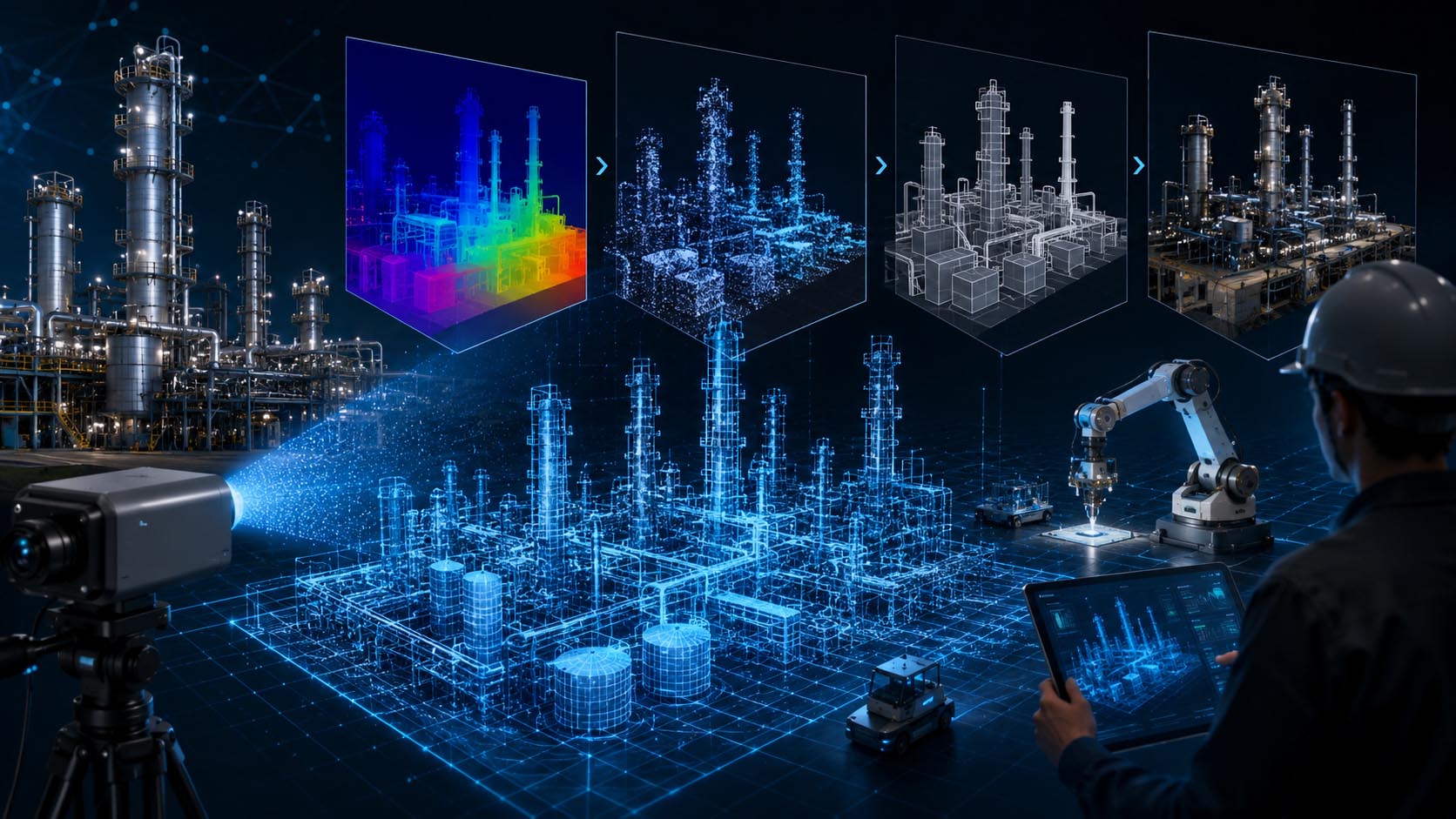
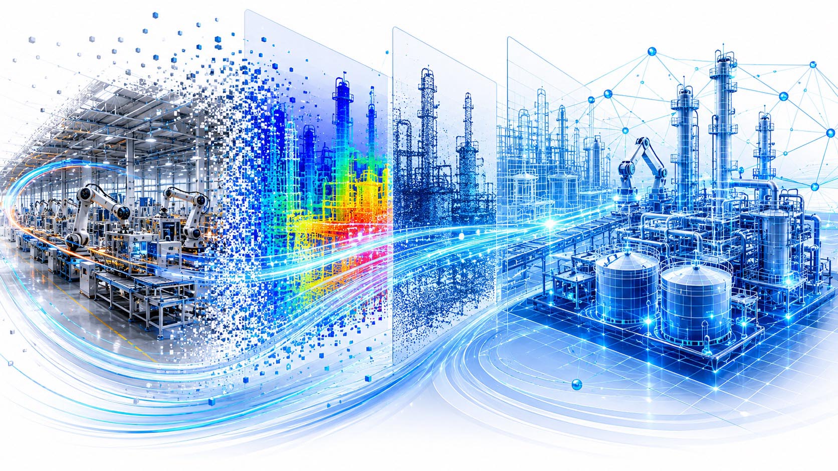
The cover image of this article visualizes exactly this transition from classic image data to spatial intelligence. A modern working environment is no longer shown merely as an ordinary scene. Instead, additional digital layers, depth information, spatial structures and intelligent analysis areas emerge above the real environment. The environment itself remains unchanged, but artificial intelligence begins to understand the world around it spatially and translate it into new digital information.
AI Supported Spatial Analysis and Spatial Data Worlds
Visualization: AI supported spatial intelligence with depth estimation, three dimensional scene reconstruction, spatial computing, digital twins and real time analysis of complex environments | Image: © Ulrich Buckenlei | VISORIC GmbH
This development becomes particularly interesting in areas such as robotics, smart factory, digital twins, spatial computing and interactive systems. In the future, machines may no longer merely process data, but spatially capture and understand real environments. This creates new possibilities for navigation, analysis, simulation and intelligent human machine interaction.[3]
Companies are also increasingly addressing the question of how spatial data can be integrated into real work processes. Especially at the interface between real time technologies, computer vision and interactive platforms, new systems are currently emerging that connect real and digital worlds more closely. This is precisely where specialized teams are increasingly developing new approaches for intelligent visual systems and spatial applications.
The real question is therefore no longer only what a camera sees. Increasingly, the question is whether digital systems will understand in the future what surrounds them and how new forms of spatial intelligence can emerge from this.
- AI can derive spatial information from images
- Modern models generate depth data from ordinary images
- Digital twins are becoming increasingly realistic without complex sensor technology
- Spatial AI opens up new possibilities for industry and XR
- Machines are beginning to understand real environments three dimensionally
This development becomes especially exciting where image data is no longer merely analyzed, but transformed into complete spatial models and intelligent digital worlds.
Why Images Suddenly Understand Depth
For a long time, computers viewed images much like a flat surface made of pixels. A system could analyze colors, recognize shapes or identify individual objects, but one decisive component of human perception was missing: spatial understanding. A photo of a room may have shown walls, furniture or people, yet for machines it often remained unclear which objects were closer or farther away and how they were spatially related to one another.[4]
This is exactly where artificial intelligence is currently changing the rules of the game. Modern depth estimation models do not simply analyze individual image areas, but learn to interpret spatial relationships. Perspectives, shadow gradients, object sizes, movement patterns and countless other visual cues are considered simultaneously. This creates additional depth information that was not directly visible in the original image.[5]
Humans perform such calculations unconsciously all the time. Even when entering a room, the brain automatically recognizes distances, proportions and spatial relationships. AI is increasingly beginning to reproduce similar mechanisms and thus expands classic image recognition with a new spatial understanding.
From Flat Image to Spatial Perception
Visualization: AI supported depth estimation with spatial scene analysis, digital depth maps and real time interpretation of visual information | Image: © Ulrich Buckenlei | VISORIC GmbH
Especially modern foundation models are now showing impressive results. Systems can generate depth maps from ordinary images and reconstruct spatial structures, even though only a single camera is used. Just a few years ago, this required special sensors, stereoscopic cameras or complex hardware configurations. Today, methods are increasingly emerging that can derive three dimensional information even from simple image sources.[6]
This opens up new possibilities especially for industrial systems, digital twins, robotics and spatial computing. In the future, machines could interpret environments better, capture objects more precisely and evaluate situations spatially. New intelligent applications and spatial platforms are currently emerging especially where real and digital information are brought together.
- AI recognizes spatial relationships within images
- Depth estimation complements classic image recognition
- Single images can provide additional spatial data
- Modern models learn visual relationships independently
- Spatial perception becomes part of intelligent systems
Yet depth information alone is not enough. The development becomes especially exciting where individual pixels turn into complete spatial models and digital worlds.
From Pixels to Spatial Models
As soon as artificial intelligence begins to derive depth information from images, another decisive question arises: How do individual points and distances become complete spatial models? This is exactly where the role of classic image analysis changes fundamentally. Systems no longer merely recognize objects or depth values, but begin to spatially reconstruct entire environments.[7]
For a long time, creating realistic three dimensional models required complex scanning procedures, special sensor technology or extensive measurement data. Modern AI models now take a different path. Instead of measuring every surface individually, they learn spatial relationships directly from image information. Perspectives, material properties, viewing angles and object relationships are combined and translated into spatial structures.
As a result, an ordinary image increasingly becomes a digital scene with spatial understanding. Walls are no longer interpreted as flat surfaces. Furniture suddenly has depth. Objects receive spatial positions. Machines no longer recognize only individual elements, but complete environments with their relationships to one another.[8]
From Image Points to Digital Spatial Worlds
Visualization: AI supported reconstruction of spatial scenes with depth data, three dimensional structures, digital room layouts and real time analysis of visual information | Image: © Ulrich Buckenlei | VISORIC GmbH
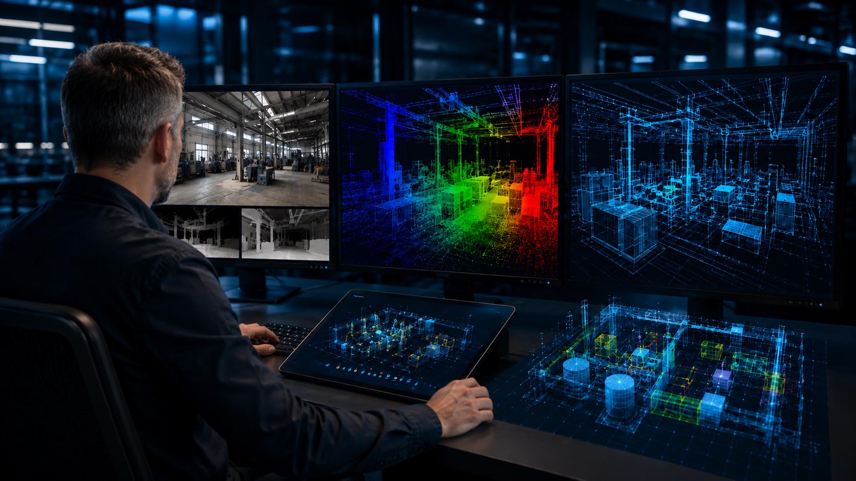
The image in this chapter shows a working environment that is no longer viewed merely as a two dimensional image. Individual objects, surfaces and areas are interpreted as spatial data structures and combined into a digital world. The visible information is not created through classic modeling, but through intelligent reconstruction from image data.
Especially modern methods such as Neural Radiance Fields or AI supported scene reconstruction open up new possibilities here. Systems increasingly generate complete spatial models that can be viewed and analyzed from different perspectives. Instead of evaluating individual images, navigable digital environments with spatial understanding emerge.[9]
This creates enormous potential especially for digital twins, spatial computing and industrial applications. Machines, production environments and real spaces could be digitized much faster in the future. Especially at the interface between real time technologies, visual analysis and spatial platforms, new systems are currently emerging that connect physical and digital worlds more closely.
- AI reconstructs spatial models from image information
- Objects receive spatial relationships and positions
- Digital scenes emerge from ordinary images
- NeRF methods generate new viewing angles and spatial structures
- Spatial models become the foundation of digital twins
Yet even complete spatial models are only the beginning. The development becomes especially exciting where these processes no longer take place only on powerful computers, but directly in the browser in real time.
When the Browser Becomes a Runtime Environment
For a long time, powerful AI applications required special software, local installations or high performance workstations. Complex calculations for computer vision, three dimensional reconstructions or digital twins usually took place on servers or specialized systems. This exact principle is currently changing fundamentally. Modern browsers are increasingly evolving from simple website viewers into complete runtime environments for intelligent systems.[10]
New technologies now make it possible to run artificial intelligence directly and locally in the browser. Instead of transferring image data to external cloud systems, calculations can take place directly on the hardware of the respective device. Modern GPUs take over tasks such as depth estimation, scene analysis and spatial reconstructions almost in real time. This creates new possibilities for faster systems, lower latencies and privacy friendly applications.[11]
This development becomes particularly interesting where ordinary image data is immediately converted into spatial information. In the future, a simple camera image could be analyzed directly in the browser. Depth information, point clouds or spatial structures would then be created immediately during use, without complex infrastructure in the background.
When Browsers Become Intelligent Real Time Platforms
Visualization: Browser based AI with WebGPU acceleration, spatial scene analysis, real time depth estimation and digital spatial computing workflows | Image: © Ulrich Buckenlei | VISORIC GmbH
The image in this chapter shows an intelligent working environment in which spatial data structures and AI analyses are no longer processed on remote systems. The digital interpretation of the environment is created immediately during use and expands classic browser interfaces with spatial information and three dimensional data layers.
Especially modern technologies such as WebGPU and local AI inference systems accelerate this development. Applications that previously depended on server farms or specialized hardware are increasingly becoming executable directly on end devices.[12]
This creates new possibilities especially for spatial computing, digital twins and interactive industrial applications. In the future, systems could recognize, analyze and spatially interpret real environments without users having to install additional software. It is precisely at this interface that specialized real time teams and immersive technology companies are increasingly working on scalable platforms for intelligent spatial applications.[13]
- Browsers are evolving into intelligent runtime environments
- AI calculations can be executed locally on devices
- WebGPU accelerates spatial analyses in real time
- Digital twins become more easily accessible
- Spatial computing increasingly reaches ordinary end devices
Yet spatial data alone does not create value. The development becomes especially exciting where complete digital representations of real systems emerge from this information.
Digital Twins Without Specialized Hardware
Digital twins were long considered complex systems that required special sensor technology, laser scanners or elaborate measurement procedures. Especially in industrial environments, physical machines, production lines or entire buildings were often captured with expensive hardware and then transferred into digital models. This exact process is now beginning to change fundamentally. Modern AI models could in the future use ordinary image data to transform real environments into digital representations much more easily.[14]
Instead of complex surveying, artificial intelligence analyzes spatial relationships, depth information and object structures directly from image material. Individual images or video sequences increasingly provide enough information to digitally represent three dimensional scenes, machines or spaces. As a result, digital twins could be created much faster and more cost effectively.
What is particularly interesting is that digital twins represent far more than simple three dimensional models. They are increasingly developing into intelligent data platforms that connect real processes with digital information. Machine states, production data, maintenance information or usage analyses can be directly linked with virtual representations.[15]
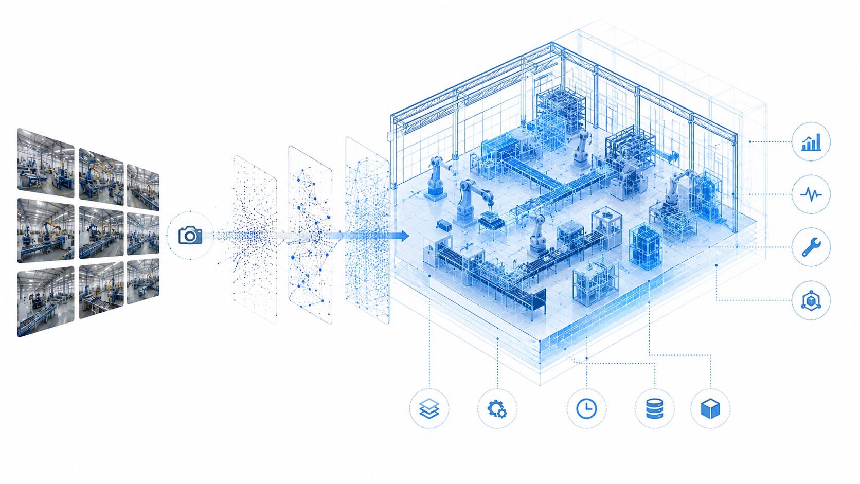
Digital Twins from Ordinary Image Data
Visualization: AI supported reconstruction of digital twins with spatial analysis, real time data and intelligent three dimensional system models | Image: © Ulrich Buckenlei | VISORIC GmbH
The image in this chapter shows a real working environment that is simultaneously represented as a digital system model. Machines, objects and spatial structures no longer appear as isolated elements, but as interconnected digital information layers. The physical space and its digital representation increasingly begin to merge.
This opens up new possibilities especially in industry, robotics and smart factory environments. Production lines could be digitized almost automatically. Maintenance scenarios could already be simulated virtually before real interventions take place. Even complex building structures could be continuously analyzed and updated.[16]
Real time platforms are also gaining importance as a result. Modern systems connect spatial reconstruction, visualization and live data streams into interactive environments that make processes more understandable and transparent.[17] It is precisely at this interface that specialized real time teams and immersive technology companies are increasingly addressing the question of how spatial data can be made intuitively usable. The Munich based VISORIC expert team also views such systems not merely as technical models, but as interactive platforms for analysis, simulation and digital decision making processes.
- Digital twins are increasingly created from ordinary image data
- AI reduces the need for special sensor technology
- Spatial data is connected with real time information
- Production environments can be digitized faster
- Digital models are evolving into intelligent data platforms
This development becomes especially exciting where machines not only create digital representations, but increasingly understand and interpret their environment independently.
When Factories and Machines Understand Their Environment
Spatial intelligence becomes a decisive factor especially where machines no longer merely execute commands, but actively perceive and interpret their environment. Until now, many industrial systems have been based on clearly defined processes, fixed positions and predefined work areas. Changes in the environment often had to be considered manually. This exact principle is now beginning to change fundamentally.[18]
Modern systems increasingly combine camera based perception with artificial intelligence and spatial analysis. Machines no longer recognize only individual objects, but understand relationships within their environment. Production lines, workpieces, transport routes or people are not viewed in isolation, but interpreted as part of a spatial system.
This creates entirely new possibilities for industrial processes. Robots could dynamically detect obstacles, track material movements or evaluate complex situations contextually. Production environments become more flexible and intelligent as a result. Instead of depending on rigid processes, machines increasingly begin to react to real situations.[19]
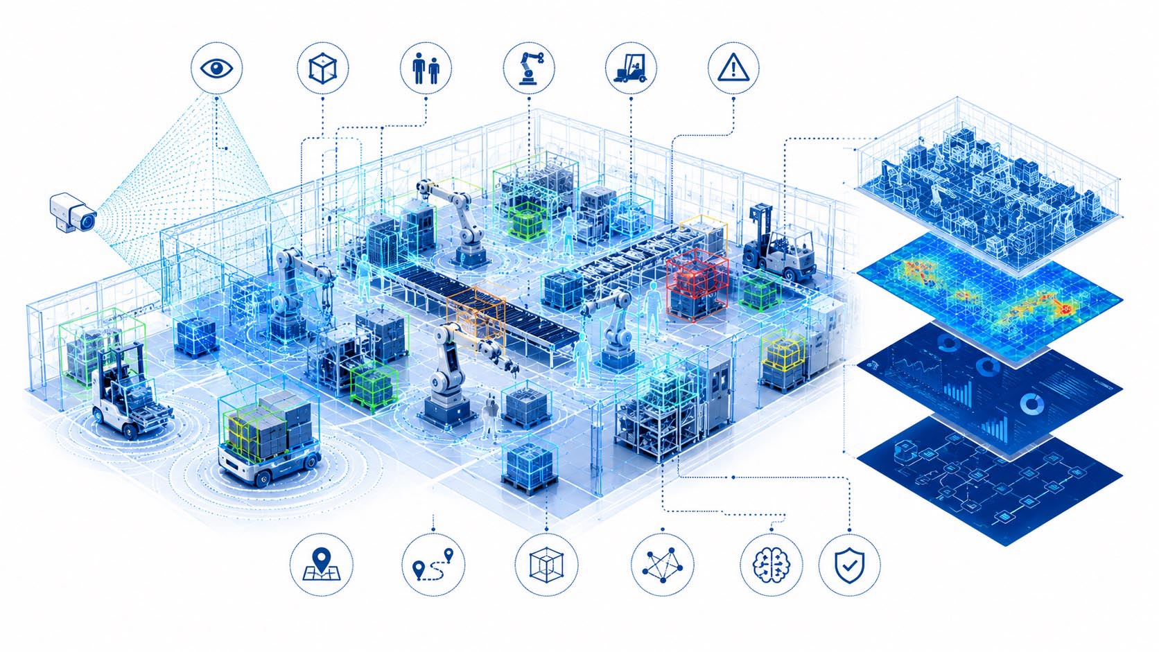
When Machines Understand Their Environment Spatially
Visualization: AI supported production environment with spatial perception, real time analysis, intelligent machines and digital information layers | Image: © Ulrich Buckenlei | VISORIC GmbH
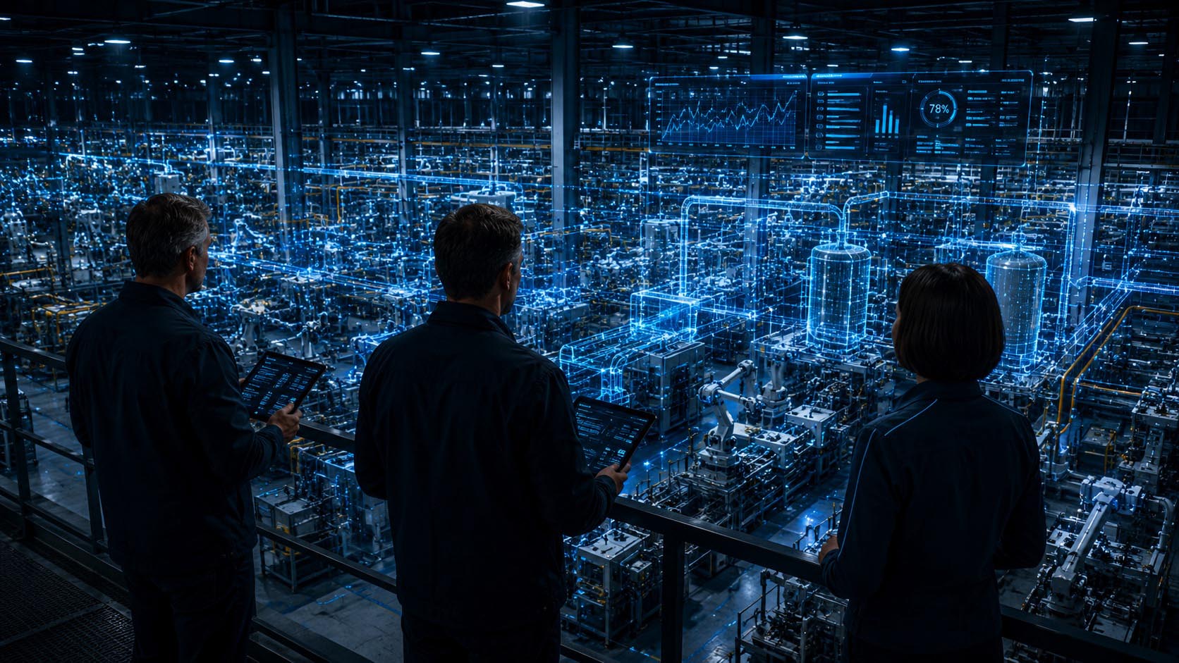
The image in this chapter shows an intelligent industrial environment in which machines no longer capture their surroundings exclusively through classic sensor values. Spatial data structures, depth information and digital layers expand the perception of physical systems and enable a much more comprehensive understanding of complex working environments.
Especially in combination with robotics and digital twins, this development opens up new potential. Production environments could be automatically mapped and continuously updated in the future. Changes within real systems would then become immediately visible in the digital representation. AI systems could detect anomalies, optimize processes and provide decision support.[20]
New fields of work are currently emerging especially at the interface between computer vision, real time platforms and industrial data spaces. Companies are increasingly dealing with intelligent visual systems that make processes more transparent and efficient. The Munich based VISORIC expert team also views spatial intelligence in such contexts not as an isolated technology, but as a connection between real time data, visual analysis and interactive digital platforms.[21]
- Machines are beginning to understand spatial relationships
- AI analyzes production environments in real time
- Robotics reacts more flexibly to real situations
- Digital twins connect real and virtual processes
- Production systems are evolving into intelligent environments
Yet spatial intelligence changes not only machines and industrial environments. The development becomes especially exciting where people, products and real spaces themselves become interactive interfaces.
When People, Products and Spaces Become Interfaces
Spatial intelligence changes not only industrial processes or digital twins. The development becomes especially exciting where physical objects and real environments themselves become interactive interfaces. Information increasingly leaves classic displays and begins to appear directly within our environment. Products, spaces and even people could in the future receive additional digital layers of meaning.[22]
Instead of calling up information on separate screens, content could become visible directly in the spatial context. A product could display technical properties directly on its surface. Medical systems could visualize anatomical information spatially. In retail environments, customers could virtually configure products or experience different variants immediately. Information would no longer exist separately from the object, but become part of the real environment.
What is particularly interesting here is the connection between computer vision, spatial recognition and artificial intelligence. Systems increasingly begin to interpret people, objects and spatial situations as connected scenes. This creates new forms of interaction that feel significantly more intuitive than classic user interfaces.[23]
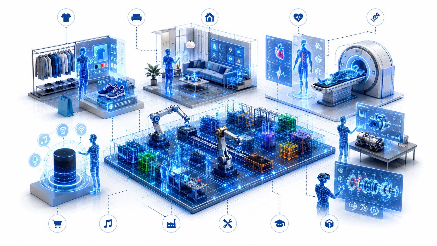
When Real Objects Become Intelligent Interfaces
Visualization: Spatial AI with interactive information layers, intelligent product worlds, digital objects and immersive real time interfaces | Image: © Ulrich Buckenlei | VISORIC GmbH
The image in this chapter shows an environment in which information is no longer tied to classic screens. Digital content appears directly on products, inside spaces and in the immediate spatial context. Physical objects thereby become active carriers of information and develop a new form of visual intelligence.
This creates new application possibilities especially in areas such as retail, healthcare, industry and experience design. Products could be explained dynamically. Training could take place directly on the object. Medical systems could visualize complex data in a more understandable way. At the same time, new spatial platforms are emerging that connect real objects and digital content more closely.[24]
New potential is also emerging at the interface between visual perception and human centered technologies. Immersive systems in particular are increasingly addressing the question of how information can be made more understandable, intuitive and emotionally accessible.[25] The Munich based VISORIC expert team also views such systems not in isolation as technical visualization, but as an intelligent connection between interaction, real time data and spatial understanding.
- Products and spaces are evolving into intelligent interfaces
- Information appears directly in the spatial context
- Digital content merges with physical objects
- Interactions become more intuitive and natural
- Spatial AI changes the relationship between people and information
This shifts the role of digital systems once again. Information is no longer merely displayed. It increasingly becomes part of the real world and our direct perception.
When Spatial Intelligence Becomes Everyday Reality
Many developments around spatial intelligence still feel futuristic today. At the same time, current technologies already show that artificial intelligence is increasingly beginning not only to recognize physical environments, but to actively understand them. The real change is not only in the technology itself. It fundamentally changes how people interact with information, products and digital systems.[26]
In the future, digital systems could become much more deeply integrated into everyday environments. A smartphone could spatially interpret its surroundings and add additional information directly into the field of view. Vehicles could capture their environment more precisely and assess situations more effectively. Workplaces could automatically adapt digital content to real situations. Even products or buildings could receive additional digital information layers.
As a result, spatial intelligence is increasingly evolving from an isolated technology into a new digital infrastructure. Systems no longer respond only to individual inputs. They begin to analyze spatial relationships, interpret situations and provide information in context.[27]
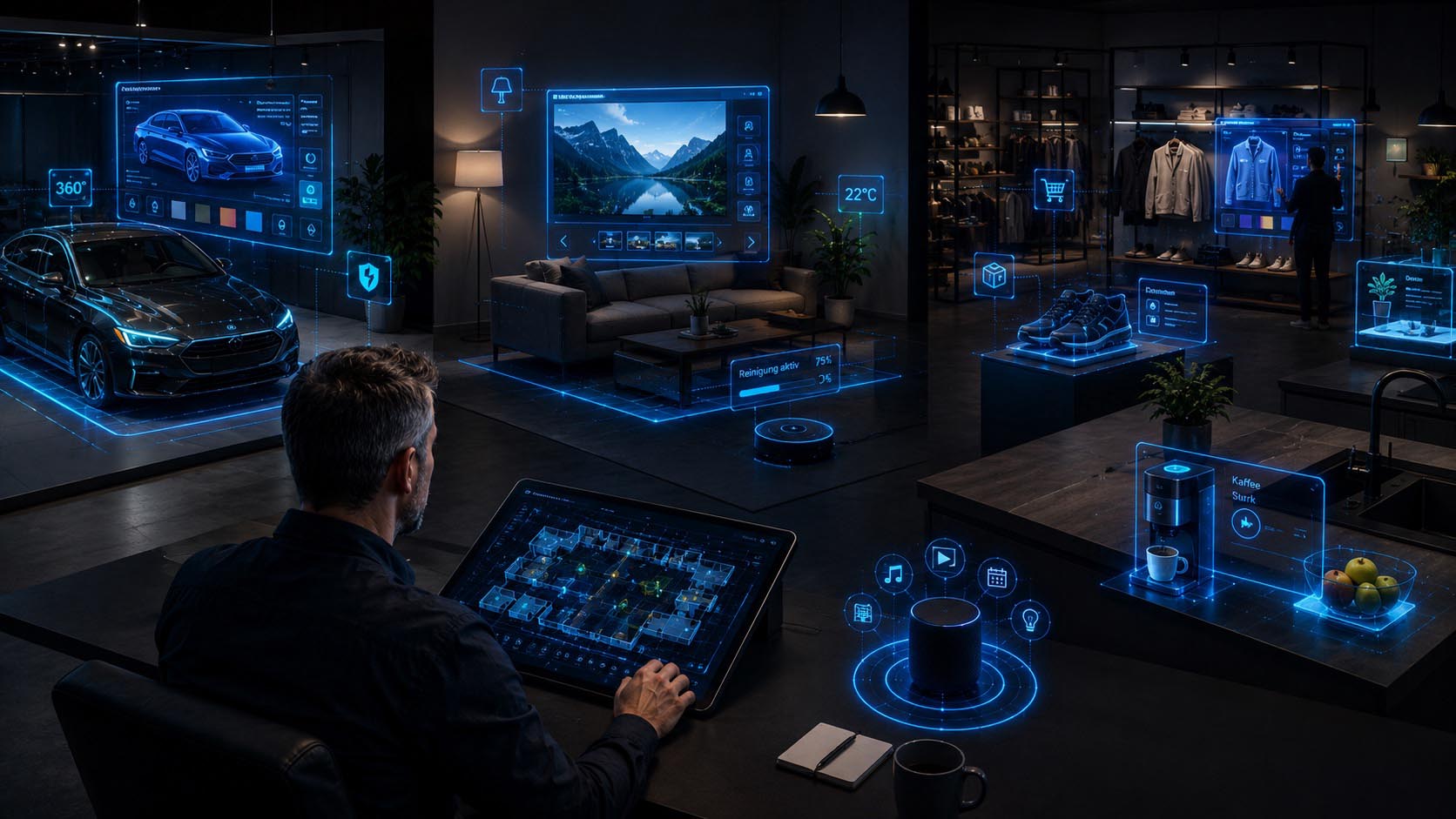
When Spatial Intelligence Becomes Part of Everyday Life
Visualization: AI supported spatial systems with intelligent environments, digital information layers, real time analysis and connected three dimensional data worlds | Image: © Ulrich Buckenlei | VISORIC GmbH
The image in this chapter shows a future environment in which real spaces, people and digital information increasingly merge. Digital layers no longer appear separately on screens, but are perceived as part of real situations. Information emerges exactly where it is needed.
Especially in combination with digital twins, real time data and intelligent platforms, new application scenarios emerge. Systems could continuously analyze real environments and dynamically adapt their representation. Spaces are increasingly evolving into intelligent information environments.[28]
New economic opportunities are also emerging. Companies are increasingly working with spatial analysis, intelligent interfaces and digital services that are directly connected to physical environments. New digital ecosystems are emerging especially at the interface between computer vision, spatial computing and real time platforms. The Munich based VISORIC expert team also views such developments not as isolated technical solutions, but as a connection between visual perception, real time data and usable digital platforms.[29]
- Digital systems are beginning to understand real environments spatially
- Information increasingly appears in the real context
- Spatial AI connects physical and digital worlds
- Digital twins are evolving into intelligent platforms
- Spatial intelligence becomes part of everyday applications
Spatial intelligence is therefore still at the beginning of its development. Yet even today, it is becoming clear how strongly artificial intelligence could change the way machines, products and people perceive their environment. This is also the focus of the following video and the additional visual examples in this article.
When Images Begin to Understand the World Spatially
Spatial intelligence already shows today how strongly the relationship between artificial intelligence and real environments could change. Images are no longer merely flat information surfaces. They are increasingly evolving into spatial data sources from which depth information, digital models and intelligent interpretations emerge. Systems therefore begin not only to recognize content, but to understand real relationships.
The following video visually summarizes this development. It shows how ordinary image information can be transformed into spatial data structures and how digital layers, depth maps and intelligent scene analysis can emerge from them. Individual images increasingly evolve into interactive three dimensional environments.
Visualization: AI supported spatial intelligence with real time depth estimation, three dimensional scene analysis and intelligent spatial computing workflows | Source material and technical inspiration: Veyda Labs | Analysis, storyline and editing: © Ulrich Buckenlei | VISORIC GmbH
The real development does not begin with a single camera or a specific AI model. What matters is the ability of digital systems to spatially interpret real environments and derive usable information from them. This is exactly where a new connection between computer vision, spatial perception and intelligent data processing emerges.
For industry, robotics, smart factory, healthcare, spatial computing and digital twins, this creates new possibilities. Machines could better understand their environment. Processes could be analyzed spatially. Digital systems could recognize relationships and present information much more intuitively.
The Munich based VISORIC expert team also views this development in connection with real time 3D, computer vision, digital twins and intelligent spatial computing platforms. The key question is how spatial data can be visualized in an understandable way and integrated into real work processes over the long term.
- Image data is evolving into spatial information sources
- AI generates depth data and digital models in real time
- Digital twins become more easily accessible
- Spatial AI connects real and digital systems
- Machines are beginning to understand their environment
Spatial intelligence is therefore still at the beginning of its development. Yet it is already clear today that artificial intelligence not only recognizes content, but increasingly begins to spatially interpret our world.
From Spatial Intelligence to Real Applications
Spatial intelligence is currently evolving from a fascinating technological idea into a concrete tool for real applications. Images become data spaces. Cameras evolve into intelligent sensors. Digital twins increasingly emerge from ordinary information, and systems begin not only to recognize their environment, but to understand it spatially.
For companies, this creates new opportunities far beyond classic visualization. Production environments can be digitally captured. Machines could intelligently interpret their surroundings. Interactive platforms could make data more understandable. Products, spaces and processes can increasingly be transferred into spatial information systems. This is exactly where new potential arises for industry, healthcare, smart factory, training, XR applications and intelligent digital services.

Spatial intelligence connects computer vision, real time technologies and digital twins into new interactive platforms and intelligent applications.
Visualization: Interactive spatial computing platforms with real time data, digital twins, computer vision and intelligent spatial information systems | Image: © Ulrich Buckenlei | VISORIC GmbH
Especially at the interface between computer vision, artificial intelligence, real time 3D and digital twins, new solutions with direct value for companies are currently emerging. Not every technology requires complex sensor technology or elaborate hardware. Often, the most exciting possibilities arise where existing systems are used more intelligently and expanded spatially.
The Munich based VISORIC expert team works precisely on these questions. How can spatial data be visualized in an understandable way. How can interactive digital twins be built. How can intelligent platforms emerge that connect real processes with visual information. And how can new technologies be used meaningfully without creating unnecessary complexity.
- Computer vision and spatial AI for real business processes
- Interactive digital twins and real time platforms
- XR applications for industry, training and intelligent assistance systems
- Visual data platforms for analysis and decision making processes
- Individual concepts for intelligent spatial applications
Contact the VISORIC expert team and discover how spatial intelligence, computer vision and real time technologies can expand real business processes.
Contact us:
Email: info@xrstager.com
Phone: +49 89 21552678
Sources and References
- Stanford – Make3D, “Generating 3D Depths & Videos”, early foundational work on generating spatial depth from single images and a historical reference point for AI supported depth estimation. [1]
- MIT Vision Book, “Learning to Estimate Depth from a Single Image”, scientific classification of monocular depth cues, image understanding and learning based methods for spatial interpretation. [2]
- Depth Anything V2, foundation model for monocular depth estimation from images and videos with a large data basis and strong generalization capability. [3]
- Depth Anything V2 at OpenReview, scientific publication on model architecture, efficiency, accuracy and application possibilities of modern depth estimation from single images. [4]
- Stanford CS231A, “Monocular Depth Estimation”, technical foundational source on scale ambiguity, depth estimation and spatial reconstruction from a single image. [5]
- Meta AI, “DINOv2”, research on self supervised computer vision learning and robust visual features for tasks such as depth estimation and scene understanding. [6]
- Mildenhall et al., “NeRF: Representing Scenes as Neural Radiance Fields for View Synthesis”, foundational research on reconstructing spatial scenes and new viewpoints from image data. [7]
- Google Research, “Reconstructing Indoor Spaces with NeRF”, research on reconstructing real indoor spaces from image material and generating navigable spatial models. [8]
- Meta Reality Labs, “SceneScript”, research on 3D scene reconstruction, room layout understanding and AI supported interpretation of physical environments. [9]
- MDN Web Docs, “WebGPU API”, technical documentation on modern GPU computing in the browser and foundation for performant local AI and visualization workflows. [10]
- ONNX Runtime, “Using the WebGPU Execution Provider”, documentation on local execution of AI models in the browser with GPU acceleration. [11]
- W3C, “Web Neural Network API”, specification for hardware accelerated on device inference on the web and privacy friendly local AI execution. [12]
- web.dev, “WebGPU is now supported in major browsers”, platform reference on the growing availability of WebGPU in modern browsers. [13]
- McKinsey & Company, “Digital Twins: The Next Frontier of Factory Optimization”, analysis of economic value, industrial application and optimization potential of digital twins. [14]
- NVIDIA Omniverse, platform reference for industrial digital twins, simulation, real time 3D and physically based virtual environments. [15]
- Siemens, “Comprehensive Digital Twin”, classification of digital twins across product, machine, production and factory environment. [16]
- Unity, “Digital Twin Definition and Industry Workflows”, overview of real time 3D, visualization, simulation and interactive digital representations of real systems. [17]
- NVIDIA Isaac, platform reference for robotics, camera based perception, navigation and industrial robotics workflows. [18]
- NVIDIA Isaac ROS, “Camera Based Perception with Isaac Perceptor”, technical reference on camera based spatial perception for robots and autonomous systems. [19]
- MIT News, “Teaching Robots to Map Large Environments”, research on efficient 3D mapping of complex environments with reduced hardware effort. [20]
- Siemens, “Digital Twin Composer”, practical reference to 2D and 3D data, real time information, simulation and industrial decision support. [21]
- Google Research, “Bringing 3D Shoppable Products Online with Generative AI”, research on generating interactive 3D product views from a few images. [22]
- Meta AI, “SAM 3D”, research on 3D reconstruction of objects, people and scenes from single images. [23]
- Unity, “Digital Twins for Retail”, application perspectives on spatial retail planning, product visualization, space simulation and interactive customer experiences. [24]
- Siemens Healthineers, “Humanizing MedTech”, classification of spatial, visual and human centered technologies in the medical context. [25]
- Deloitte, “Future of Spatial Computing”, analysis of spatial computing, data integration, enterprise interfaces and the connection between physical and digital working environments. [26]
- World Economic Forum, “AI Powered Digital Twins and Industrial Ecosystems”, classification of digital twins, industrial data spaces and AI supported ecosystems. [27]
- Video Depth Anything, research project on temporally consistent depth estimation in video sequences and further development of monocular depth models. [28]
- Depth Anything 3, research project on the further development from single image depth toward consistent any view geometry and spatial reconstruction. [29]
- Veyda Labs, social demo on monocular depth estimation from webcam feed with local ONNX and WebGPU processing. [30]
- Depth Anything V2 Demo, Hugging Face demo for fast visualization of depth information from image material. [31]
- Xenova, “WebGPU Real Time Depth Estimation”, browser demo for real time depth estimation from webcam video with WebGPU. [32]
- DepthAnything on Browser, GitHub project for browser based depth estimation with ONNX and Three.js. [33]
Contact Persons:
Ulrich Buckenlei (Creative Director)
Mobile: +49 152 53532871
Email: ulrich.buckenlei@visoric.com
Nataliya Daniltseva (Project Manager)
Mobile: +49 176 72805705
Email: nataliya.daniltseva@visoric.com
Address:
VISORIC GmbH
Bayerstraße 13
D-80335 Munich